Fleetville, Camp, Hill End, Marshalswick, Oaklands, Smallford, Cell Barnes, Cunningham, Ellenbrook, Granville, Beaumonts, Tyttenhanger
Updated: 17th April 2026
The "East End" reference harks back to 1912 when a prominent councillor, during a debate on the subject of enlarging the city's boundaries to take in Camp and Fleetville, likened the unfinished streets and general untidiness as similar to London's East End.
SAOEE blog
James Halsey's Sawmills

You are more likely to smell the soft odour of cut timber at B&Q today; but the genuine smell of fresh cut timber comes from a sawmill. A place such as from former Lavers in Fleetville. Or, of course even further back from James Halsey at Butterwick Wood. It would be so good to discover a picture of Halsey's sawmill, but so far such proof has not yet been discovered.
London Colney Secondary
Where were the teaching areas?

We are hoping to establish what the teaching areas were used for before the 1980 fire and before final school closure. Open the poster to find out more. Additional map and identification added on 25 June to blog post titled LONDON COLNEY SECONDARY SCHOOL dated 6 June.
Recollections
Marconi in High Wycombe

We would like to know where in High Wycombe (it seems in an old furniture factory) was part of Marconi based during WW2? Some of its employees travelled the thirty miles each day from St Abans to work there. For the firm is must have been worth the cost of employee travel.
Green news
Green energy

A different style of petrol cap is now appearing on many of our cars; and instead of "filling up" we are plugging in to what is familiarly known as a charging point. There's a long way to go but our roads are becoming steadily more green.
Friday pic
Scouting's Highest Honour

Wartime newsprint brings a rather inferior image of a very special award given to a very special St Albans Scout. He was Alan Kerrs who, for his bravery, was awarded the Cornwell Badge. Courtesy Herts Advertiser.
East end schools
Nicholas Breakspear

A 1960s initial build on this Colney Heath Lane site, the Nicky B school is now undergoing a radical re-build for the 21st century.
100 Objects
Each object has a story to tell...

… and this one remembers all whose lives were affected by the design and construction of the family of aircraft known as the Mosquito. It stands near the entrance of the de Havilland Museum , Salisbury Hall.
Books
Nearly 60 books about St Albans

Many books have been written about St Albans. Not all are currently in print, however, but may be available from your local library. Each new book published is bound to be located on this page.
Additional books included
March 9th 2026
East End Maps
The groups of roads down to 1960.

How old is a road? Was it a track? Has its name changed over time? When was it first laid out? This is a quick reference guide to the growth of of where we all live. Illustration above from the Bryant (1822) map of our East End.
Topics
Plenty of choice for you to explore

There are 25 pages of topics about the East End for you to discover, from districts to shopping streets, a turnpike and former hospitals, and a number of former factories of national renown – and of course shops. The former Rats' Castle is now the Old Toll House.
Questions
but as yet no complete answers

Plenty of questions; among them more detail is needed on a series of football teams from the 1940s under the group banner Carlton. We have a few team pics but don't have details on the background to the organiser at a Hatfield Road address.
Your turn
Adding your own contribution

Here is a Hatfield Road home about to bite the dust – to be replaced by two smaller houses on the same site. The plot's history is in My Turn.
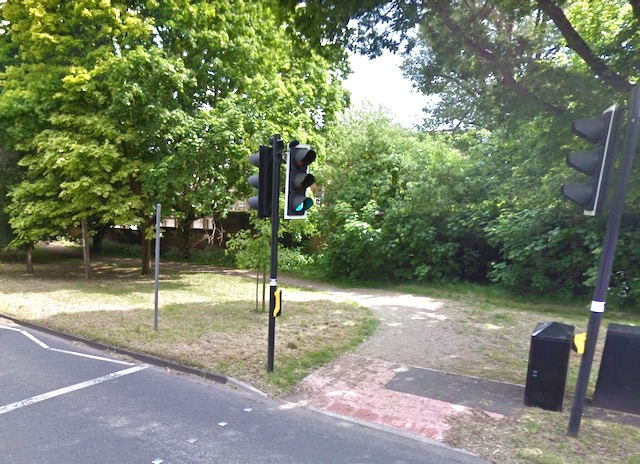
The Green Ring

A walking and cycling route encircling the city, with many sections off-road and through our East End. Above the route passes through St Saviour's View.
The eastern Green Ring
At the light controlled crossing join the cycle path on the south side of Sandpit Lane parallel with the road.

At the lower end of St Saviour's View join Lemsford Road until the public path on the left after Eastbury Court.

Use the public path to cross the railway bridge to reach Jennings Road.

At the bottom of the first section of Jennings Road cross over Clarence Road to the longer section, passing Verulam School on the right.

At the junction with Woodstock Road North turn right over the brick table, travelling south.
Keep Brampton Road on your right and follow Woodstock Road South. Until reaching Hatfield Road the road width is narrow and parking is an issue.

At Hatfield Road use the light-controlled crossing to the Morrison's side. Cycle on the mixed use path in front of the store towards Sutton Road.

At the junction with Sutton Road use the road, passing Castle Road on your left.

Turn right off the road at the junction with Alban Way. Alban Way is a continuous cycle path as far as Griffiths Way, with a connection to the City Railway Station.
Local lottery

Fleetville Community Centre, Highfield Park Trust and Trestle Theatre are among groups who now have a fundraising local lottery page. We all have an opportunity to donate and hopefully win prizes.
St Albans District Community Lottery
New this Spring St Albans District Council has launched the St Albans District Community Lottery.
Already about twenty-five community groups are participating with their own page on
www.stalbansdistrictlottery.co.uk
We choose our good cause.
Fleetville Community Centre
Highfield Park Trust
Trestle Theatre Company
among more than twenty others
Sign up and decide how many £1 tickets you wish to play each week. Click Play to discover all live causes. The full details are are provided on the website.
You decide how much you would like to help raise towards the community group's target. And there is always the possibility of winning a prize.

Highfield Park

One of our East End's green lungs is Highfield Park, now occupying much of the land of Hill End and Cell Barnes Hospitals. Open every day and with special events advertised on its website: www.highfieldpark.trust.co.uk
New Centre
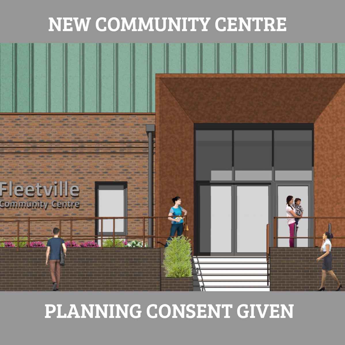
The planning application for the new Centre was approved a few years back. The Council, however, has delayed the building project, and we are now waiting for further news. Delay may also be created by the re-organisation of local authorities in the county.
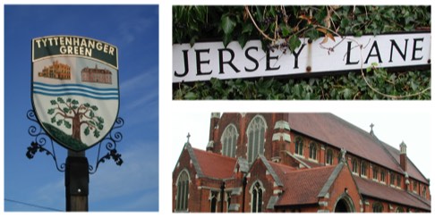
Jersey Lane

The Greenspace Action Plans (GAPs) in our East End are produced by Countryside Management Service on behalf of Hertfordshire County Council. Following the significant GAP for Alban Way a similar GAP oversight is in place for Jersey Lane.
Bike shop times 3
Due to open in October 2022 in a new shop unit is TREK BIKES. See also panel titled Montague Close. With the increased popularity of cycling of all kinds it is unsurprising that this business has been added to those of BC Cycles adjacent to Grimsdyke Lodge and St Albans Cycles at St Brelade's Place. All now offer a wide range of repair, maintenance, service and insurance options – owning a bike is not the cheap option it used to be!
Photo courtesy VIC FOSTER.
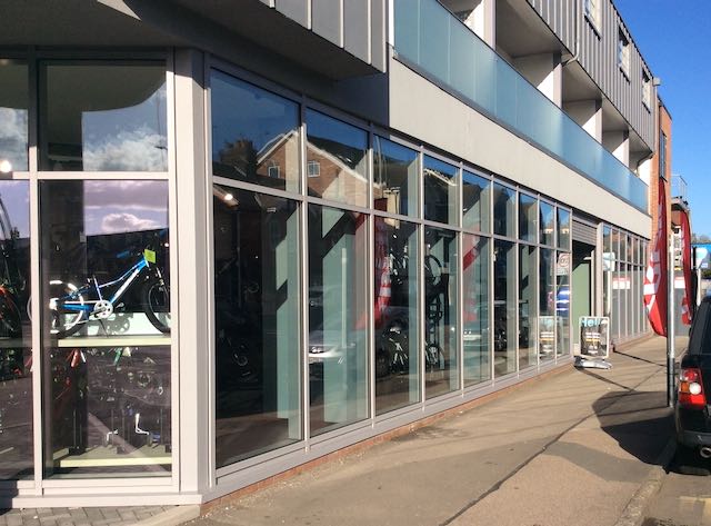
Trek joins Fleetville retail
An activity which enthuses the broadest spectrum of our local population for travel, leisure and sport. Perhaps gender, age and ethnicity might be better represented by cycle shops generally, not just the products they sell.
Found the shelters
History has recorded, through the recollections of living in Fleetville during the Second World War, the existence of tunnel shelters under the Community Centre and below the grass sward of the recreation ground.
Only one memory referred to brick street shelters in the road space of Royal Road, and that was not specific.
The publication of a series of RAF aerial photos in a flyover during 1946, now shows what appears to be a line of six such shelters on the left side of the roadway outside what used to be the wartime nursery and today is the community centre.
A larger version of the photograph appears on the Wartime East End page.

Shelters along Royal Road
Inside the orange rectangle can be seen a line of brick structures: six of them. The former nursery is at the left edge of the rectange.
Uplift at Royal Road
A detached house built for a general practitioner in the pre National Health days, was transformed into flats, and a small house was built in the garden. In a further extension of over development came recently when a truck arrived with another floor which was lifted onto the now-removed original roof. I'm not sure what nearby residents think of the addition, but it is certainly very different from the original Fleet House.

From two floors to three
Prefabicated in a factory and lifted from a loader which had backed into Royal Road. Image courtesy VIC FOSTER.
Yet More Fleetville Homes
Cape Road and Burleigh Road lead to the former branch railway (now Alban Way). When the early houses gave out the space beyond was utilised by W G Bennett, builders. During and after the Second World War the site was occupied by Kia-Ora Motors before becoming Pratts building suppliers, and then PSR building materials.
Now, proposals for 37 new houses and flats by developer Cresswick have been given planning approval. There has been some concern that the number of units is very tight for the footprint, and there is also a very limited amount of space for car parking.

Developed by Horace Slade
Councillor Horace Slade purchased the land c1900, which has spent all of its life as an industrial site.
Cape Road continued
You might have imagined the Cape road new homes you had heard about would now be completed, marketed and occupied. After all, most of us pass the site by as we walk, ride or motor along Hatfield Road. But building developments do sometimes falter, and the part completed estate on the former PSR Building supplies site adjacent to Alban Way came to a pause and the development, partly finished, is up for sale.
We can see what it it will look like when complete, but for now all we can do is to inspect Watling Real Estate, website, for plans, architect's images and a downloadable brochure.

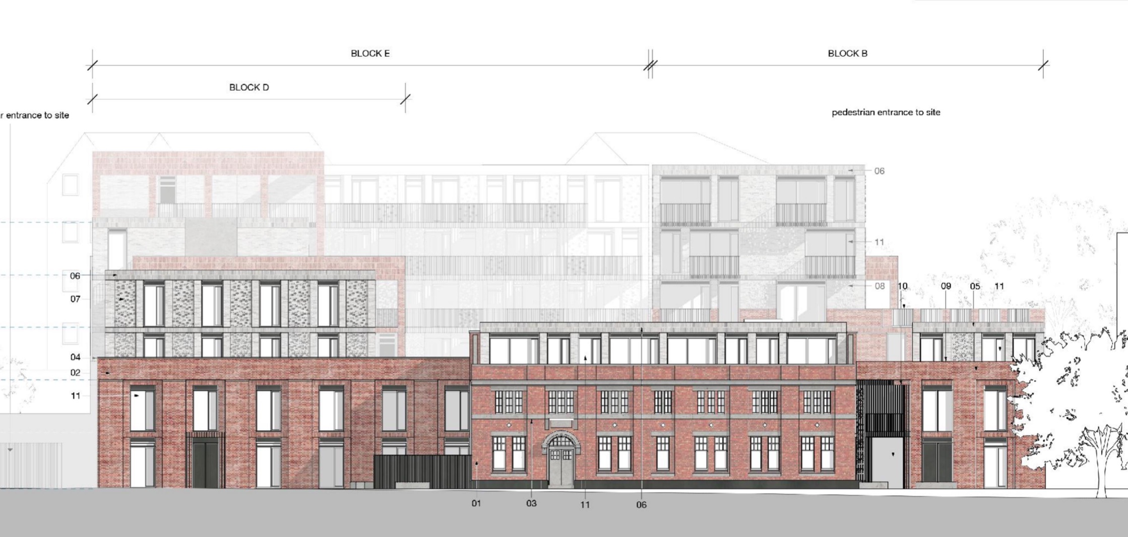
Viciniti in Fleetville
... at some time in the future. Image courtesy WATLING ESTATES.
A meeting of Sanders – and Moons
Fleetville Diaries, the local history people, hosted a magnificent celebration of two related families: descendants of Frederick Sander, the "Orchid King", and descendants of Henry Moon whose exquisite paintings of the orchids Sander bred were published in four massive tomes.
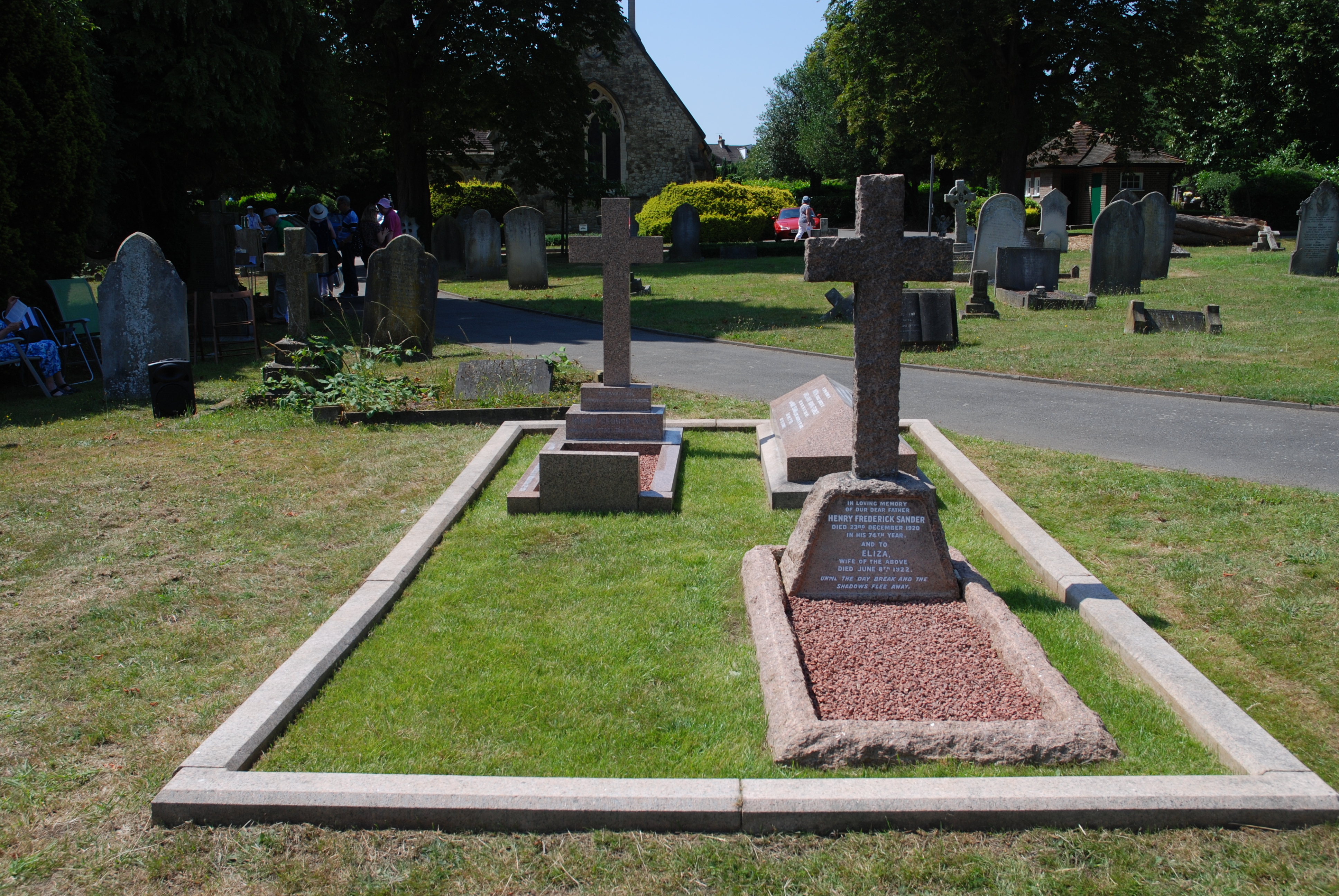

Sander & Moon Tribute Day
The result of Fleetville Diaries' project to renovate the family plot of the Sander/Moon families, was seen by eighty invited guests to Hatfield Road Cemetery and members of the Moon and Sander families.
Old Electricity Works
Final approvals have now been given to the Campfield Road site which once housed the city's first electricity works (1908), of which the locally listed frontage remains. The proposals, which had progressed through several iterations, include adaptations to the frontage building, and new blocks of 1, 2 and 3 bedroom flats on the former generating plant ground to the rear.
The site has Sphere Industry on the east side and is surrounded by the former Herts Advertiser HQ (now Phoenix House), Apex House, Centurian Court and Baker's Close.

Courtesy David Gaylard.
The "Sparks" development
Work has begun on the frontage building of the former electricity generating works in Campfield Road.
This might be a Tyttenhanger group
Peter has a copy of this photograph of a very casual-looking group, and he suspects this was a cricket team raised from the residents of Tyttenhanger Green, or perhaps from staff working at Hill End Hospital. Cell Barnes Hospital is discounted as the date of the picture is c1930, a few years before the opening of Cell Barnes Colony. One man has tentatively been identified as Henry Eames (front row centre).
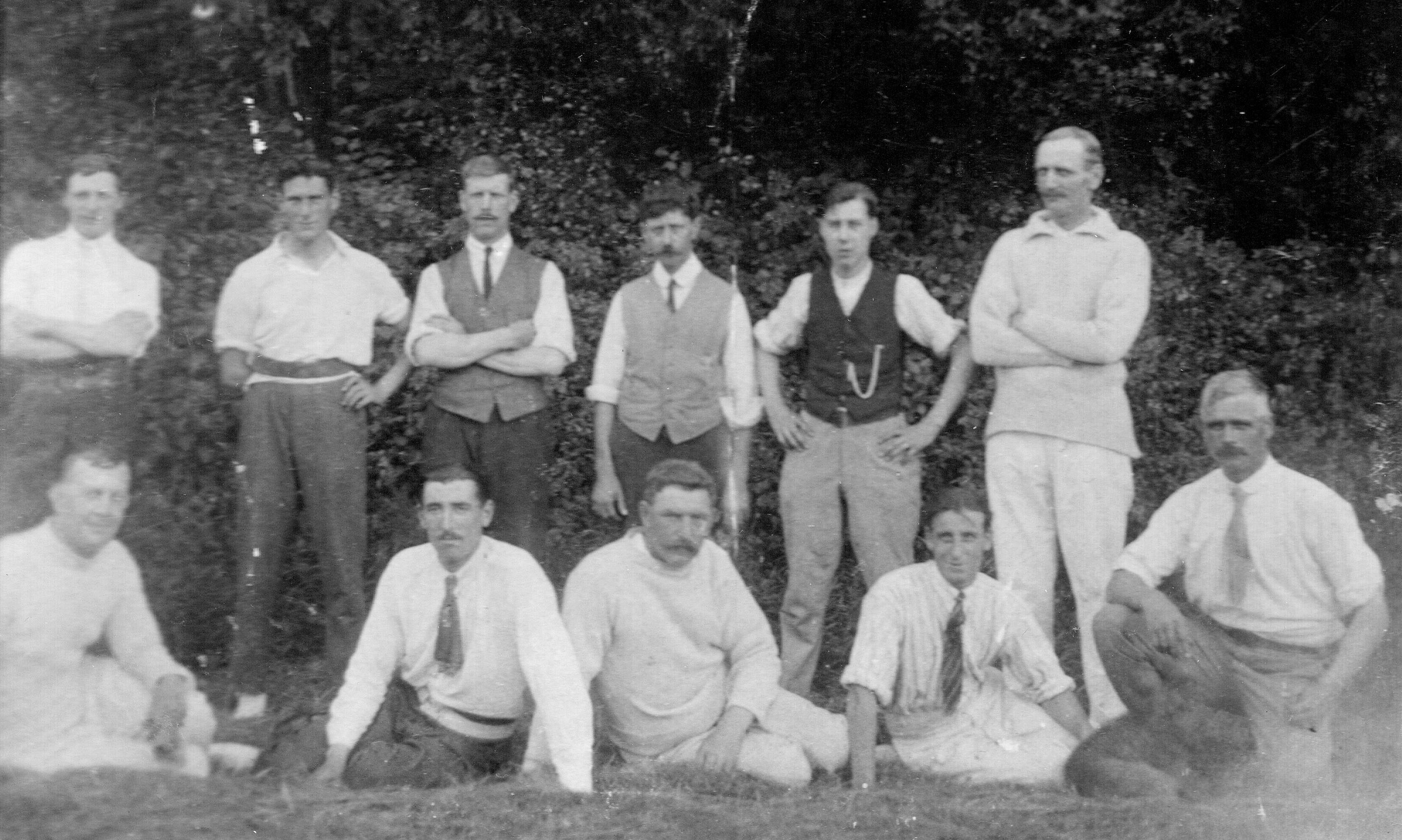
Test Eleven?
Somehow this does not look like a football team. so let's think cricket. Is there anyone you might recognise?
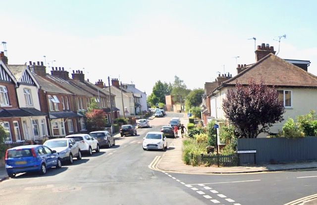
Fleetville streetscapes
The ladder roads in Fleetville are surprisingly far from the same, although they were largely the estate of one man in the pre World War One period. There is a mix of narrow detached, semi-detached and small terraces. There is a sense in there being no typical streetscape in the formerly named Slade Building Estate. But they are certainly popular residences.

Sandfield Road west
Most plots were the original landlord's choice, but there were later infills too where 1920s and 1930s homes were added to the mix by their owners.
Second editions under way
Did you miss the opportunity to grab a copy of either or both volumes of the first editions of St Albans' Own East End? Perhaps you borrowed a copy from a library, or hoped a friend or relative might offer you a copy as a birthday or Christmas gift? Or maybe you've made much of your patience and are sitting it out in hope.

Welcome news
Preparations are well under way on second editions, including new content. Keep an eye on this panel for updates.
Coaching trips
Coaches everywhere take parties, groups and individuals to a variety of venues and destinations; even to and from employment, school and college. Even the most basic of daily school journeys use vehicles with a plush spec normally reserved for travel overseas.
Plush sixty years ago would have meant a vehicle such as this. Do you recall travelling in such a vehicle?

Leisure travel in the fifties
Albanian (then Premier Albanian), Brunts, Reg's, New Green's Travel, Crain's... Only later came Club Cantabrica and PPH Hire. Remember any others?
Highfield Park Trust 25
Highfield Park Trust has now celebrated its 25th anniversary, taking on the role of managing the former parkland of Hill End and Cell Barnes hospitals in 1996. Tim Abbott, Chair of HPT, stated, " In one sense 25 years is a long time, but in another it really isn't. We have done well but we must keep developing in order to reach our full potential."

Celebrate 25
Mayor Edgar Hill and Caroline Hill, Daisy Cooper MP and Trust Chair Tim Abbott at the celebratory gathering. Photo Highfield Park Trust.
We went to the Odeon Cinema

The fourth full cinema on this site, and the third building, currently the only remaining full-time film theatre in the city. Visit the Odyssey to witness today's comfort.
We went to the Chequers Cinema
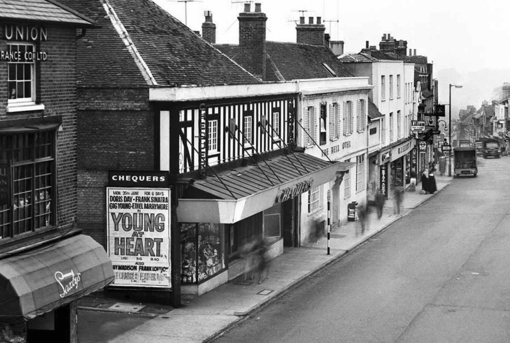
First opened on the site of a former brewery operation in Chequer Street, the Chequers was the only cinema in the centre of St Albans.
We went to the Gaumont Cinema

The only cinema east of the Midland Railway and therefore in the East End, the Gaumont (formerly called the Grand Palace) was in the otherwise residential Stanhope Road.
Early Camp memory
Mr Gear's shop

Now number 155 Camp Road the above house was once a general store and post office, first opened by Thomas Gear in the first decade of the 20th century. Mr G Trottman then took over. Are there any photographs of number 155 as a shop?
Early Marshalswick
Commemorative trees

The residents' association for the formative Marshalswick estate around The Ridgeway west, purchased a number of flowering almond trees for planting in the roadside verges during the Festival of Britain year, 1951. Apparently 112 were acquired. Was there a significance to this number, or was it simply the number that could be accommodated or afforded along the roads which were planted?
Early school journey
School goes to the Gower

Mr Belcher, a teacher of Fleetville School, took a group of children to Port Eynon, on the Gower, in June 1955. If you were in that group, please tell us all about your trip. We know that the return journey was delayed by a rail strike, and it seems likely there was much confusion in the attempt to keep the school and the parents informed.
Usage links
Key pages
© 2026 St Albans' Own East End Mike Neighbour